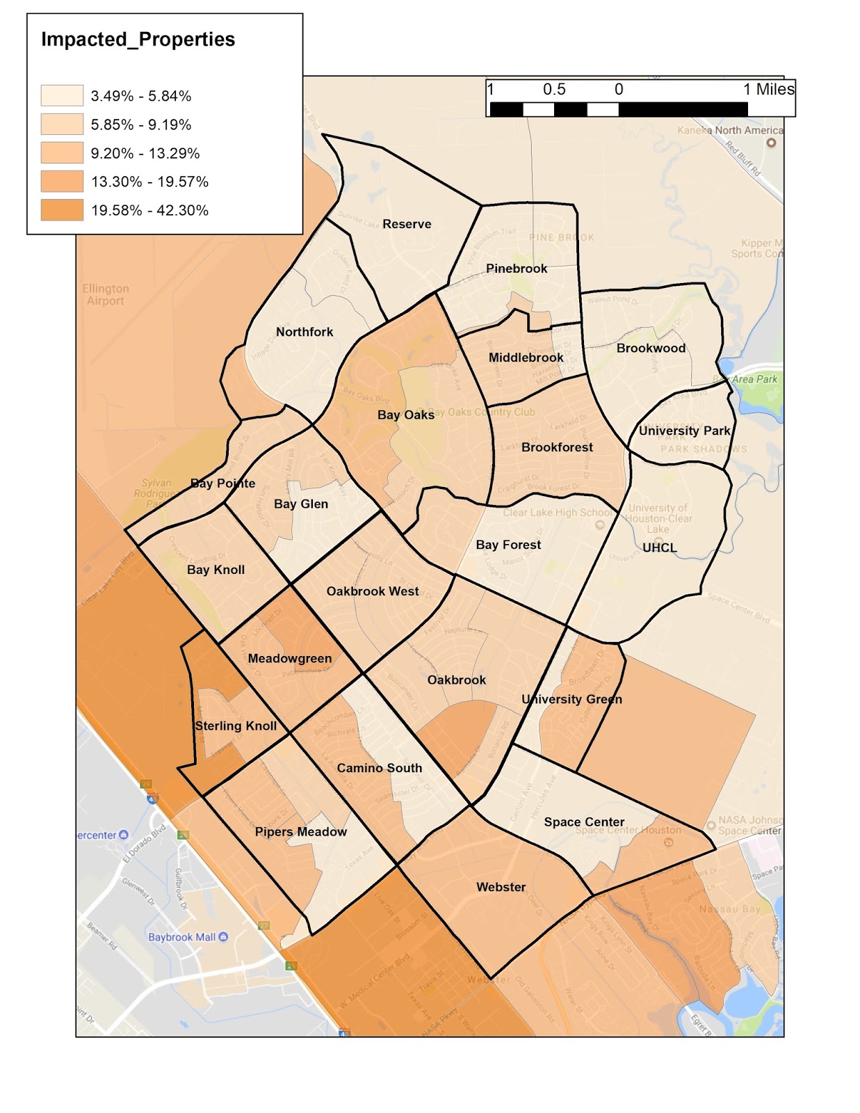
Where was damage from Harvey in the Clear Lake City area?
Actual flooding and damage to houses and structures is compiled by FEMA in the form of claims made to the National Flood Insurance Program (NFIP). This information for individual structures is privacy-protected and not available to the public. Customarily the only information available concerning flooding history is the Comprehensive Loss Underwriting Exchange (CLUE) report provided to home buyers by insurance agents.
However a knowledgeable Geographic Information Systems (GIS) mapper can research and present various data to illustrate flooding history. The attached example shows the percentage of properties impacted by Harvey, mapped by Census Tract Block Groups in the Clear Lake City (CLC) area. These block groups quite often coincide with the CLC neighborhoods. This data is based on the number of applicants to FEMA for disaster assistance, so it is not limited to NFIP policyholders only.
Note the very low percentages of damaged properties in the neighborhoods on the west side of Armand Bayou, which is a significant Special Flood Hazard Area (SFHA). In contrast there are higher percentages of damaged properties in neighborhoods along the western portion of Clear Lake City that do not contain SFHAs.


Comments
Post a Comment