Where are the high flooding risk areas of Clear Lake City, TX?
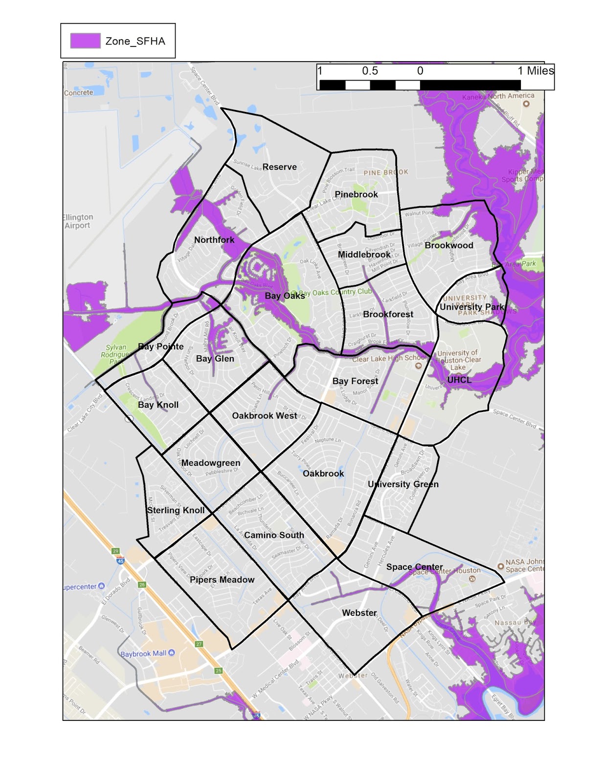
The areas with the highest risks for flooding are mapped as Special Flood Hazard Areas (SFHA).
Special Flood Hazard Areas represent the area subject to inundation by 1-percent-annual chance flood. Structures located within the SFHAs have a 26-percent chance of flooding during the life of a standard 30-year mortgage. Federal floodplain management regulations and mandatory flood insurance purchase requirements apply in these zones.
In Clear Lake City the Armand Bayou, Horsepen Bayou, and Cow Bayou drainages and tributary ditches compose the SFHAs. The Bay Glen and Bay Oaks neighborhoods in particular have multiple houses located in current SFHAs. Many other houses in these and other neighborhoods are mapped as partially within SFHAs.
Note the location of your home in relation to the SFHAs. Does this map help you to understand why flooding did (or did not) happen in your neighborhood?


Comments
Post a Comment