Exploration Green project - significant mitigation of flooding in Clear Lake City?
A November 17, 2017 article by Katie Riordan in the Texas Tribune entitled "In search of a flood fix, one Houston community turned to a golf course" summarizes the Exploration Green project.
Many Clear Lake City residents are familiar with this project, which is now in the early phases of development. It is a joint effort by Exploration Green Conservancy and the Clear Lake City Water Authority (CLCWA) to convert the 227-acre site of the defunct Clear Lake Golf Club into a series of five storm water detention ponds surrounded by hike and bike trails, wetlands, and greenbelts. For details on the Exploration Green project please refer to the link below:
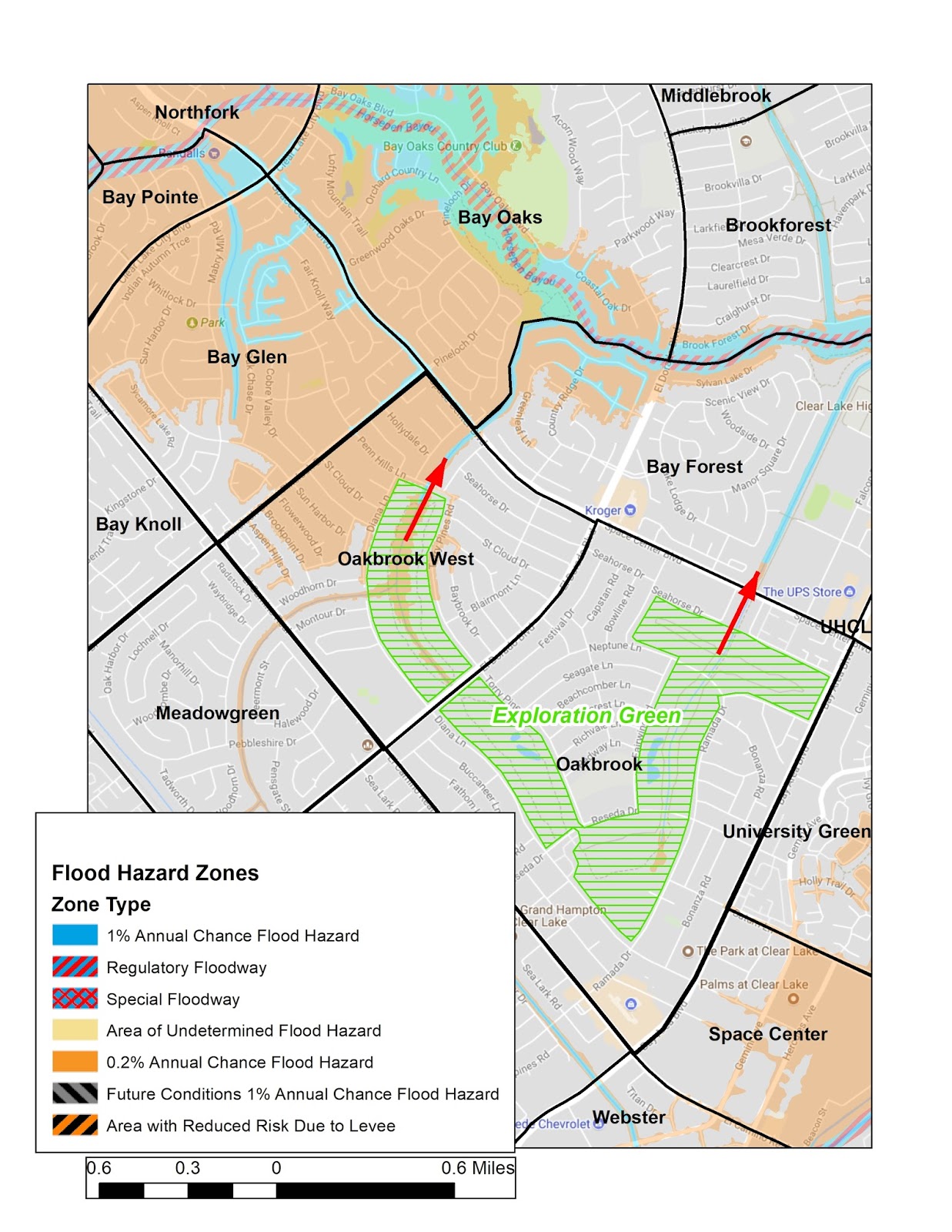
During Hurricane Harvey the Phase 1 detention pond (in the area south of Reseda Drive between Diana and Ramada) was mostly complete and did act to mitigate flooding of a significant number of homes in the vicinity. An interesting claim in the article is a quote from John Branch, the president of CLCWA, in which he estimates that up to 3,000 homes will no longer be in either the 100- or 500-year floodplain - areas with a 1 percent or 0.2 percent chance of flooding in a given year.
This is certainly significant for Clear Lake City residents and prospective home buyers if it actually does come to pass. Three thousand homes would include virtually all of Bay Glen, Bay Oaks, Northfork, Bay Pointe, and northern Oakbrook West (refer to map).
The floodplains themselves are based mostly on topography and would not change. What would change is the level at which they would be filled with water during storm events. Detention of storm water in the Exploration Green ponds would retard flow into the floodplains via the existing flood ditches and surrounding lows (highlighted by red arrows).
CLC residents - are you aware of the Exploration Green project and the claim of significant floodwater mitigation? Do you believe that the flood hazard maps will actually be revised to shrink/remove the current 100-yr and 500-yr floodplains as implied by CLCWA?


Comments
Post a Comment